This blog is maintained as an effort to coordinate and collocate responding agencies' information for easier public access during events on the Kenai Peninsula. The information here is written and provided by the contributing agencies. NOTE: The blog will be updated as the need arises and may be dormant at times.
Monday, August 19, 2019
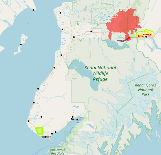
08/19/19 Update to the Interactive Map
An overlay has been added to the Kenai Peninsula Fire Viewer interactive map for Diamond Ridge neighborhoods, Sterling neighborhoods and Cooper Landing that are currently in the Level 1 "READY" alert status. You can access the map HERE and on the right side of this blog. You have the option to zoom in for more detail - just note that it may take time to generate the map. The overlay is an indicator to be prepared. There is a fire in your local area. The "READY" alert is NOT a notice to leave. This alert means
that you must be ready for potential evacuation. Assist family members with special needs, arrange to move mobile property
(boats, trailers, ATV), and prepare pets or livestock. Monitor social media,
news and radio for information, or call the Borough Call Center at 907-262-INFO
(4636) for updates. For more information on Ready-Set-Go! preparedness click HERE. NOTE: The interactive map was formally titled Swan Lake Fire.
Kenai Peninsula Fire Viewer - Interactive Map
No comments:
Post a Comment
Note: Only a member of this blog may post a comment.

No comments:
Post a Comment
Note: Only a member of this blog may post a comment.